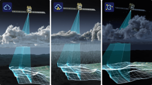
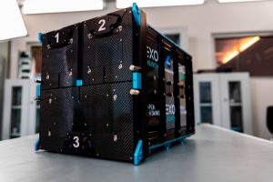
They’ll be working to provide a product combining Insight Terra’s cloud-based IoT Insight Platform with Synspective’s analytical models of SAR data. Satellites and earth observation coupled with ground sensors will monitor the operations of the global mining industry. For example, to monitor ground movement and land deformation, which are risk indicators for failures of tailings facilities, mine walls, and water dams.
Strix
Synspective develops and operates high-frequency, high-resolution SAR satellites called “StriX” to provide data sets. It has placed three satellites into orbit, which collect data with a ground resolution of 1m (in Sliding Spotlight mode), and 3m (in StripMap mode), and a swath width of 10-30km.
The Japanese company says that with its third StriX satellite, and onsite data acquired by Insight Terra, it will be able to increase the availability of analytical data, and help mitigate potential catastrophes. It plans an eventual constellation of 30 satellites by the late 2020s.
In April last year, Synspectiv raised US $100m in a Series B funding round, which was led by Sompo Japan Insurance, Nomura SPARX Investment and Pavilion Capital Pte.
“Space has been an important part of Insight Terra’s heritage,” said Insight Terra co-founder and CEO, Alastair Bovim. “Adding Synspective’s earth observation data bolsters our space enabled data and monitoring capabilities and is integral to our mission of protecting people, and the environment, from potential disasters such as the mine tailings facilities collapse in South Africa just this September.
“The integrated mine monitoring solution that we will deliver in partnership with Synspective including satellite connectivity and earth observation data, real time IoT, and valuable ground truth sensors and data, will be a huge step toward this goal.”
SAR
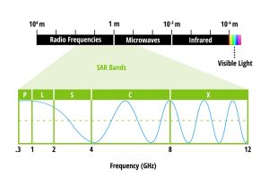 An advantage of synthetic aperture radar – compared to typical optical imagery – is that it enables day-night, all-weather imaging. It can be described as a type of active data collection, where a sensor records the amount of energy that is reflected back to it, making it responsive to surface characteristics, such as building structures and atmosphere moisture.
It is a “synthetic” aperture, says NASA, in the sense that a sequence of data acquisitions from a shorter antenna are combined to simulate what would be much larger antenna. See the agency’s image, right.
One competitor to Synspective in this field is ICEYE, the Finnish SAR satellite imagery specialist.
In November of last year, ICEYE signed a deal with the U.S. Army to advance the Earth observation technology supporting army missions, and it has also been contracted to provide imagery for ESA’s Copernicus satellite programme.
Images: top, Synspective; bottom, NASA
See also: Picture of the Day: Oxford Space Systems’ Wrapped Rib antenna
 Electronics Weekly Electronics Design & Components Tech News
