Distributor Rutronik has added three surface-mount RTK-enhanced GNSS modules from Unicore to its portfolio. RTK – ‘real time kinematics’ – is a service that increases the accuracy of satellite navigation systems. UM982 GPS L1/L2/L5 BDS B1I/B2I/B3I GLONASS G1/G2 Galileo E1/E5a/E5b QZSS L1/L2/L5 SBAS 16 x 21 x 2.6mm UM980 BDS B1I/B2I/B3I/B1C/B2a/B2b GPS L1/L2/L5 GLONASS L1/L2 Galileo E1/E5a/E5b QZSS L1/L2/L5 SBAS ...
Tag Archives: GPS
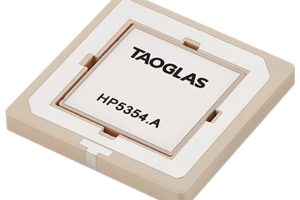
Dual-band patch-in-patch GNSS antenna is 4mm thick
Taoglas has inset one antenna inside another to cover GNSS L1 and L5 with a 35 x 35 x 4mm surface-mount device – which is optimised for use on a 70 x 70mm ground plane. Designed using a custom electro-ceramics formula, HP5354.A offers “stacked patch L1-L5 performance” within a single patch-in-a-patch solution, according to the company. It “has a passive ...
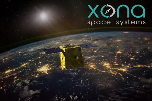
Xona geolocation service provider raises $19 million Series A
Xona Space Systems, a startup geolocation service provider, has raised $19 million in Series A funding to develop the satellite network for its PULSAR navigation system. The company said the funding round – led by Future Ventures and Seraphim Space – was oversubscribed and new investors NGP Capital, Industrious Ventures, Murata Electronics, Space Capital, and Aloniq took part. Xona says ...
The importance of being on PNT
Increasingly space can be viewed as a critical infrastructure, says Alun Williams, with utilities and services relying on reliable PNT information systems. Many sectors of a modern society – think water systems, transportation systems or financial services, for example – increasingly rely on data or services from space-based systems. Arguably one of the most important areas involves the provision of ...
Module provides 10m location accuracy and LTE-M for IoT comms
U-blox is sampling a module that combine LTE-M cellular communication (23dBm output) and GNSS for precise location finding. SARA-R520M10 is the super-set device, combining on-board an LTE-M and NB-IoT IC (v2 of UBX-R5) with the company’s M10 GNSS receiver IC, allowing concurrent communication and location-finding in a 16 x 26 x 2.2mm package. Cellular coverage is global, and the module ...
RFoF reinforces military communications
The stakes have never been higher for reliable and efficient communications for military use, says Meir Bartur, of Optical Zonu. In an era where technological advancements such as automation are transforming every aspect of military operations, reliable and efficient communications have become paramount. When the Pentagon received $7.5bn in 2021 to fund unmanned systems across the US Air Force, Army ...
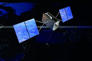
ESA plans to bring satnav closer to Earth with FutureNAV
ESA is planning an in-orbit demonstration with new navigation satellites that will orbit just a few hundred kilometres up in space. It is part of its FutureNAV initiative. The long-term goal is to bring satnav closer to Earth, by extending GNSS and supporting positional navigation and timing (PNT) services from low Earth orbit (LEO) . The mini-constellation will eventually supplement ...
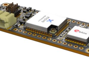
LoRa, GNSS and cloud service on Arduino MKR-style module for 15km range IoT
Move-X is aiming at tracking applications that need meter-level accuracy and a long-range battery-powered wireless connection with a module that is physically compatible with Arduino’s 63mm long MKR boards. Called Cicerone, it is built around u-blox’ MAXM10S GNSS (sat nav) receiver module and Move-X’ MAMWLE LoRa transceiver module, which has a Semtech SX126x inside. “This combination allows for synergy between ...
Most Read articles – DRAM collapses, WAAS Navigation, RF testing
There's a contract to refine a space-based precision navigation system, news of an earthquake in Taiwan, Pickering Interfaces' PXI RF matrix modules, the temperature of the semiconductor industry, and the DRAM market deflating...
Raytheon to modernise space-based WAAS navigation system
The U.S. Federal Aviation Administration (FAA) has contracted Raytheon to further refine the space-based precision navigation system WAAS (Wide-Area Augmentation System). Specifically, Raytheon Intelligence & Space will modernise the system, in terms of system security, network architecture and adding dual frequency service. WAAS was developed by the Federal Aviation Administration to augment GPS services by increasing its accuracy and availability. ...
 Electronics Weekly Electronics Design & Components Tech News

